Durmitor National Park, Montenegro
Contents
- 1 IntroductionDurmitor National Park (42° 58'-43° 17'N, 18° 16'-19° 27'E) is a World Heritage Site and is located in the northeast of the Republic of Montenegro, Yugoslavia. (Durmitor National Park, Montenegro)
- 2 Geographical Location
- 3 Date and History of Establishment
- 4 Area
- 5 Land Tenure
- 6 Altitude
- 7 Physical Features
- 8 Climate
- 9 Vegetation
- 10 Fauna
- 11 Cultural Heritage
- 12 Local Human Population
- 13 Visitors and Visitor Facilities
- 14 Scientific Research and Facilities
- 15 Conservation Value
- 16 Conservation Management
- 17 IUCN Management Category
- 18 Further Reading
IntroductionDurmitor National Park (42° 58'-43° 17'N, 18° 16'-19° 27'E) is a World Heritage Site and is located in the northeast of the Republic of Montenegro, Yugoslavia. (Durmitor National Park, Montenegro)
Geographical Location
In the northeast of the Republic of Montenegro, Yugoslavia. Lies approximately 30 kilometers (km) to the south west of Pljevlja and 30 km north of Niksíc. Lake Pivsko runs from north to south 5 km from the western border, and the village of Zabljak is located close to the north eastern border 42° 58'-43° 17'N, 18° 16'-19° 27'E
Date and History of Establishment
 Republic of Montenegro, Yugoslavia. (Source: University of Vermont)
1952 as a national park (Sluzbeni list Nar. Rep. Crne Gore "No. 14/1952). Inscribed on the World Heritage List in 1980.
Area
32,000 hectares (ha).
Land Tenure
State ownership.
Altitude
450 meters (m) to 2,523 m.
Physical Features
Durmitor National Park comprises Mount Durmitor plateau and the valley formed by the canyon of the River Tara, incorporating three major geomorphological features: canyons, mountains and plateaux, ranging in elevation from about 450 - 2,522 m. Because of its geographical location and range in altitude, the park is under the influence of both Mediterranean and alpine micro climates which has resulted in an exceptional range of species. Geologically, Durmitor and Tara canyons are made up of rocky massifs of the secondary era (from the lower Triassic to the upper Cretaceous), tertiary and quaternary eras. The dominant features are the limestone formations of the middle and upper Triassic, the upper Jurassic and the upper Cretaceous, especially the so-called Durmitorean flysch. The River Tara, one of the last wild rivers in Europe, has pure, clear waters, a gorge of 1,300 m depth and notable floristic and faunistic diversity. The 16 glacial lakes of the Durmitor and the canyons of the Tara, Susica and Draga rivers were formed during the Quaternary period, following the sudden thaw of the snow and the formation of glaciers on the Durmitor and neighboring mountains. The waters of the largest lake, Black Lake (Crno jezero), feed two separate river basins: the River Tara, and underground through the Durmitor Massif to the River Komarnica or Piva. There are numerous examples of weathering processes, rock shapes and land features characteristic of karstic erosion, fluvial erosion and glacial erosion.
Climate
No information.
Vegetation
 Scots pine, Montenegro. (Source: Bloomsburg University)
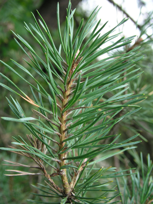
Vegetation zones, covering 17,000 ha, include deciduous forest, coniferous forest, sub-alpine zones of Fagetum subalpinum and Pinetum mughi and Alpine meadows. The dominant species include Scots pine, Norway pine, silver fir, beech, occasional birch, mugo pine and juniper. The park supports a rich korstic flora with many rare and endemic species including Verbascum durmitoreum (R), Gentiana levicalix, Edraianthus glisicii, E.sutjeskae, Valeriana braunii-blanquetii, Daphne malyiana (V), Carum velenovskyi, Saxifraga prenja, Trifolium durmitoreum, Oxytropis jacquinii, Silene graminea and Viola zoysii. There are 37 taxa endemic to the area and 6 specific to Durmitor. The park contains one of the last virgin black pine Pinus nigra forests in Europe, on soils that would usually develop beech woodland.
Fauna
The Tara and its tributaries, as well as the lakes, contain a large number of salmonidae including Salmo trutem fario, Hucho hucho (VU) and Thimalus thimalus. Forest fauna include brown bear Ursus arctos, grey wolf Canis lupus, wild boar Sus scrofa, wild cat Felis silvestris, chamois Rupicapra rupicapra, various species of eagle, capercaillie Tetrao urogallus, black grouse Lyrurus tetrix and rock partridge Alectoris graeca.
Cultural Heritage
 Canis lupus, Montenegro. (Source: Cedar Creek Natural History Area, University of Minnesota)
No information.
Local Human Population
The park has 1,500 inhabitants, with a further 8,000 in Zabljak on the eastern boundary.
Visitors and Visitor Facilities
No information.
Scientific Research and Facilities
No information.
Conservation Value
Durmitor National Park has been formed by glacial activity and cut by rivers. The deepest gorges in Europe are found along the Tara River Canyon, and the dense pine forests, interspersed with clear lakes, harbor a wide range of endemic flora.
Conservation Management
The park contains seven reserves under special management, grouped in three zones: i) Mlinski potok and Black Lake Basin containing 270 ha of mixed forest including spruce, fir, beech, black pine and maple. The unusual hydrology of Black Lake and the virgin forest of Mlinski are the principle reasons for the area's special management status. There is also a 5 ha peat bog (Barno Lake) at 1,450 m with an interesting lucustrine flora. ii) Tara Gorge Biosphere Reserve which includes the 3,000 ha gorge, 40 ha virgin black pine Pinus nigra forest which is unusually productive for growing in calcareous soil, and 70 ha Zabojski Lake with its interesting hydrology currently under studied. iii) Skrc Lakes and Susica Valley of 2,500 ha in the north-east of the park, managed to protect and facilitate the study of chamois Rupicarpa rupicarpa and other rare animals.
Management Constraints
In 1990, there were two major threats. One arose from a lead processing factory, 32 km upstream from the canyon. The holding tanks for storage of waste waters rich in heavy metals was due to fill in 1985. As it was not possible to provide new tanks and as 2,000 workers would lose jobs if the plant were closed down, the government was going to discharge wastes into the Tara River. A conservation symposium held in Montenegro declared that if this happened, the river would become biologically dead. However, it is not known if this threat was realized. The second threat was from a hydro project planned for the gorge. This has since been dropped in the face of public and international pressure and an alternative scheme has been adopted. In addition to these two threats, there has been reduction of the forested areas because of indiscriminate felling and indiscriminate building has resulted in the loss of arable land and pasture. Most of the high altitude pastures are grazed by sheep and cattle during the summer. Some of the lakes are draining into subterranean swallow-holes. According to UNESCO (1997) it has been proposed to excise an area of 40 ha from the park due to the expansion of the village of Zabljak. There were also concerns regarding the revival of plans to exploit the hydro-electric potential of the river.
Staff
Comprises a Director, ten administrative staff and 50 rangers (undated information).
Budget
2,000,000 dinars in 1979. The budget is derived from a number of sources including central Government, UNESCO (for maintenance of laboratory facilities and bear conservation), Montenegro Tourist Board, donations from industry and from charges for use of the park's facilities and resources.
IUCN Management Category
- II (National Park)
- Natural World Heritage Site - Criteria ii, iii, iv
Further Reading
- Division of Ecological Sciences, UNESCO has lists of endemic plants, the aquatic fauna and terrestrial fauna (reptiles, birds and mammals).
- Birks, H.J.B. and Walters, S.M. (1973). The flora and vegetation of Barno jezero, Durmitor, Montenegro, Glasilo Republ. zavoda za zast. prirode - Prirodnjackog muzeja Titograd, No. 5, Titograd, 1972.
- UNESCO (1997) Draft reoprt of the rapporteur. Report prepared for the Bureau of the World Heritage Committee, 21st session, UNESCO Paris, 23-28th June. Unpublished report.
- World Heritage nomination (1979). (Contains a list of references in Serbo-Croat.)
- Wojterski, T. (1971). National Parks of Yugoslavia, Poznon.
| Disclaimer: This article is taken wholly from, or contains information that was originally published by, the United Nations Environment Programme-World Conservation Monitoring Centre (UNEP-WCMC). Topic editors and authors for the Encyclopedia of Earth may have edited its content or added new information. The use of information from the United Nations Environment Programme-World Conservation Monitoring Centre (UNEP-WCMC) should not be construed as support for or endorsement by that organization for any new information added by EoE personnel, or for any editing of the original content. |